
Durham Block Records
The public route around a Durham address starts with geography, not a household roster. Durham County GIS / FAST Map can show the parcel, address point, and nearby selected features. The tax record adds the owner display and parcel reference. A recorded instrument answers a title question. City association material and neighborhood notices add civic context, but neither is a membership list. Keeping those source types separate prevents a map result from becoming an unsupported claim about who is present at an address.
| Source | What It Shows About a Block | Access |
|---|---|---|
| FAST GIS parcel layer | Parcel boundaries, REIDs, address points, and selected or buffered parcels | Public GIS with a JavaScript agreement; permitted attributes export as CSV, JSON, or GeoJSON |
| Tax parcel cards | Owner display, parcel reference, and tax attributes | Public search by address, PIN, or owner |
| Register of Deeds index | Recorded parties and instruments for block properties | Ordinary online instruments; some historical and book-series material requires office access |
| Voter-list route | Permitted name, address, precinct, and history fields | Written state-file request; confidential fields excluded |
| City association PDF | Association and neighborhood names | Official inventory, not a membership roster |
| Neighborhood notices | Addresses notified for a development meeting | DurhamMaps CSV process; a notice is not membership |
A tax owner can be a person, estate, bank, attorney, or another mailing recipient. The situs address marks the mapped property location. Neither field establishes that an owner lives there, and non-owner occupants and other household members are not enumerated on a parcel card. Record the parcel ID, address, source, and date rather than turning a nearby parcel into a social connection.
Durham Parcel Lookup
Durham County GIS / FAST Map provides a repeatable method for examining the immediate area of a property. Its documentation describes address or REID searching, parcel and address layers, point, line, and area selection, parcel buffers, a data table, and export controls. These are spatial tools. They identify which public features fall in a selected area, not the personal relationship between people connected to separate parcels.
- Search the target address or REID and confirm that the selected parcel matches the location intended.
- Turn on the parcel and address-point layers so the boundary and mapped address can be read separately.
- Use point, line, or area selection, or apply a parcel buffer, to choose the surrounding geographic features.
- Open the selected data table and note the parcel IDs, address points, displayed fields, and map source date before exporting only permitted public attributes.
- Use a parcel reference to open the tax card or a recorded instrument when the question is ownership or legal description, then label the result by record type.
Durham's parcel search can also narrow a result with a street number and street name, without requiring a complete postal address. That is useful for a starting point. For the full records chain along a named road, use the Durham street directory; a small-radius map selection should remain focused on the immediate block.
A view of the City of Durham's public resources shows the separate municipal layer behind planning and community information.
Municipal information helps place an address in a civic process, while the parcel and deed sources retain their distinct record roles.
Durham Records Compared
Official sources preserve a custodian, a record category, and a date. That makes it possible to distinguish a map feature, a tax display, a deed instrument, and a planning notice. Commercial people-data categories can combine information from many sources, but a combined display does not replace the source record and cannot establish who is currently at a property. Check the primary public record before relying on any address-related claim.
| Source category | Best use | Important limit |
|---|---|---|
| Official county or City record | Identify a defined parcel, filing, civic process, or published contact route | Scope, date, and confidential portions still control what the record proves |
| Commercial people-data category | Generate a lead to verify with the actual custodian | May be stale, blended, incomplete, or disconnected from the current parcel record |
Voter registration information has a different boundary from property data. A public North Carolina voter file may include permitted name, address, age rather than full date of birth, party, precinct, districts, and voter history fields. History reports an election and voting method, not a ballot choice. Social Security numbers, full birth dates, email, identification material, photographs, and certain signatures are protected. A broader county or selective-file request is a written state process, so the requested fields, scope, date, delivery format, and current restrictions should be confirmed before a request is made.
North Carolina public-record access permits inspection of existing records, but it does not require an agency to create a new people list from unrelated systems. The City public-record request service is the appropriate route for an existing City record when a public portal does not supply it.
A request should name the existing record, its date or address range, and the custodian rather than asking for a newly assembled block list.
Durham Civic Contacts
Durham's official neighborhood material is planning- and association-based. The City's eight-page association inventory lists districts and many neighborhood or homeowners associations, including Watts-Hillandale, Walltown-related groups, Albright, Alston Heights, American Village, Anderson Street/Wrightwood Park, and others. It is useful for identifying organizations that have been named publicly. It is not a directory of members, a claim that every nearby address belongs to a group, or a substitute for an association's own contact choices.
| Public contact route | What it can provide | Boundary to keep |
|---|---|---|
| City association inventory | Published association and neighborhood names | Eight-page inventory, not a countywide roster |
| Watts-Hillandale Neighborhood Association | Its own public mailing, board/contact route, and opt-in listserv | Participation remains organization-specific and consent-based |
| City staff directory | Published department contacts for municipal questions | Staff contacts are not neighborhood membership information |
The Durham public staff directory is a direct route to published City contacts when a planning or department question needs the right office.
Using an agency contact or an opt-in association route respects the difference between public civic communication and a private household list.
Durham Neighborhood Boundaries
A Durham neighborhood label can describe a small-area plan, census blocks, a ZIP area, a historic district, an HOA boundary, or an informal place name. City planning materials make that distinction explicit. The Future Greater Bragtown plan includes Bragtown, Oxford-Hamlin, Colonial Village, and Oxford Commons, while the Lakewood plan includes Lyon Park and Lafayette Street. Those plan extents are civic context, not proof that every address inside them shares an association or identity.
County GIS ZIP polygons add another geographic layer. Their ZIPCODE, JURISDICTI, and CITY attributes describe county-intersection postal polygons, so a city label or a ZIP intersection cannot prove city limits, county residence, or participation in a local group. Compare the parcel, plan, and postal layers one at a time.
Durham Meeting Records
City neighborhood-meeting notices document a development process, not a community roster. Applicants retrieve addresses from DurhamMaps, submit a CSV for the required notice list, and give notice at least 10 days before the meeting. That creates a dated record of who must receive notice about a proposal. It does not identify association members, show current occupants, or establish agreement with a project.
When a notice matters, preserve the meeting date, proposal context, source date, and public address-list boundary. Treat a notification address as procedural information. Do not combine it with parcel, voter, or other data to build an unsolicited contact dossier.
Durham ZIP Records
Postal geography needs its own check. The County's official ZIP layer contains county-intersection polygons, and FAST GIS can turn on that layer, select polygons, query attributes, and export the selected table. The parcel search itself has no ZIP field, and the voter lookup is organized by county rather than ZIP. A ZIP layer therefore helps describe geography, but it does not answer who is present at a particular address.
Several Durham-area postal codes cross county or city lines. Use the current GIS layer and a full-address USPS validation when the postal assignment matters. A ZIP label is not a parcel boundary, city limit, county boundary, or evidence of residence.
Durham Block Lookup
Historic context can correct a mistaken assumption about a block. Durham County Library and Duke collections hold maps, aerials, directories, newspapers, Urban Renewal material, and other dated resources. The Library of Congress Durham Sanborn record includes an August 1907 set of 21 sheets. A sheet can show a footprint, building use, fire walls, or street alignment at that time. It cannot identify every person connected to the address.
The City cemetery management route is another dated, place-based source for Beechwood and Maplewood interment context.
Cemetery, map, and directory materials work best when each record retains its own date, collection, and stated purpose.
Privacy Limits for Neighbors
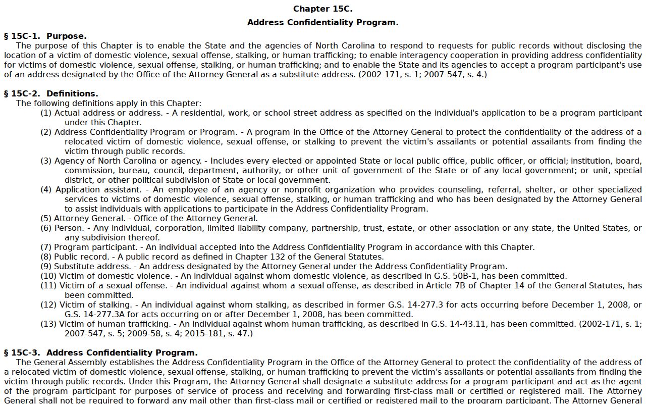
North Carolina public-record law requires agencies to respect confidential portions of records. The Address Confidentiality Program in Chapter 15C gives eligible survivors a substitute address for service and mail, with specific exceptions for elections, motor-vehicle tax functions, and recorded documents. A protected person's appearance in one database does not mean every related record is hidden, nor does it authorize sharing an address. Voter files also protect Social Security numbers, full birth dates, agency of registration, email, photographs, identification copies, driver-license numbers, and restricted signature copies.
The North Carolina Address Confidentiality Program statute explains the statutory protection behind the substitute-address route.
Correct or suppress a public-record issue through the actual custodian, and use organization contacts only where the organization has made them public.
Lawful use. Use public sources for property and civic context, reconnecting through consent-based channels, or personal safety awareness. Do not use them to monitor, threaten, harass, or assemble a contact dossier about anyone.